North West Network Greenway – Strabane to Castlefin

Strabane Castlefin
Distance
10 km
Elevation
47m
Time
Cycling: 30 mins
Walking: 2 hrs
Surface Finish
Smooth Surface
North West Network Greenway – Strabane to Castlefin
Gallery image 1
Gallery image 2

Overview

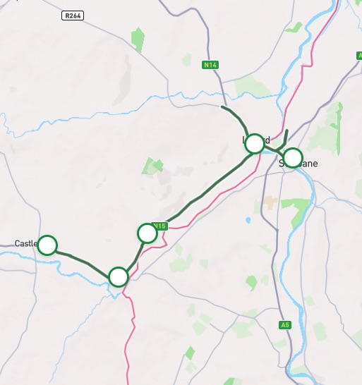
The Strabane to Castlefin Greenway is part of the North West Greenway network, an ambitious vision that aims to deliver an entire network of walking and cycling infrastructure in the border region between County Donegal and Counties Derry and Tyrone. This 10- kilometre cross border route connects the towns of Strabane, Lifford and Castlefin and runs primarily adjacent to the N15. This route offers a mixture of urban and rural landscapes and is a calm, smooth traffic-free route with wide paths offering fresh air and scenic vistas over the River Finn, one of Ireland’s premier salmon rivers. 

Strabane – Lifford

1.5 km

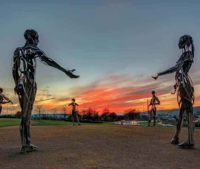
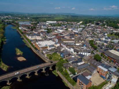
The route commences in the historic town of Strabane in County Tyrone where the greenway provides dedicated active travel around the border town and its many sights offering many points to start your journey from. Passing the distinctive “let the dance begin” art installation known locally as the “Tinnies“, you will continue to head Northwest towards County Donegal crossing the mighty River Foyle just below the confluence of the River Mourne and River Finn. This is a narrow bridge and cyclists should dismount to cross the bridge using the footpath. Crossing into County Donegal, another piece of sculpture ‘Three Coins’ at a roundabout marking the approach into Lifford. You can opt to continue straight through the roundabout to explore the town of Lifford – the county town of Donegal or you can opt to turn left at the roundabout (please be mindful of vehicles) and join the segregated route. 

Lifford – Castlefin

The Rivers Mourne Finn and Foyle are Special Areas of Conservation with qualifying interests that include Wild Atlantic Salmon (Salmo Salar) and Otter (Lutra Lutra). 

Code of conduct

Code of Conduct

To keep our greenways welcoming and safe for all users—walkers, cyclists, families, and wildlife alike—please review our Code of Conduct before you go.

Read Code of Conduct

Getting There

Whether you’re travelling by train, bus, or car, use these tools 
to plan your route.

Common Questions

How can I access the Greenway?

As the route is located adjacent to the road network, entry and exit can be gained along the length of the route.

How can I access the Greenway on public transport?

Bus services that provide connection to the greenway include:

32, x32 Dublin – Letterkenny

932 Dublin – Annagry

487 Strabane – Raphoe – Letterkenny

987 Lifford – ATU Letterkenny

489 Letterkenny – Carrigan’s – Strabane

494 Strabane – Ballybofey

288 Ballybofey – Derry

290 Ballybofey – Letterkenny hospital

Strabane town service
Links to Strabane from Belfast, Derry, Artigarvan, Donemanagh, Castlederg, Moville, Omagh, Glenmornan.

What car parking and EV charging facilities are along the Greenway?

Car parking is available is Strabane, Lifford and Castlefin town centres with convenient access. There is a small car park at Beechwood grove in Lifford and convenient parking in the CPI centre in Castlefin.

Local EV charging points include the Canal basin and railway street car parks in Strabane, the three rivers centre Lifford, Daly’s Circle K Lifford and Patterson’s kitchens 1.5km west of Lifford.

Accessible car parking spaces can be found in the canal Basin Strabane, opposite the hospital in Lifford and the CPI centre in Castlefin.

What is the surface type on the Greenway?

The entire route is smooth with no gravel surface along the route.

Are there any water facilities along the Greenway?

No water fountain facilities are available on the route

Are there any bike parking, repair and hire facilities along the Greenway?

There are bike parking facilities available at the following locations:

Strabane – Old railway line

Lifford – Opposite hospital

Lifford – Beechwood grove

Ballylast – Opposite Ballylast NS

Castlefin – Opposite CPI centre

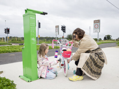
There are bike repair stations at the following locations:

Strabane – Canal Basin

Strabane – Barnhill Road at ASDA

Lifford – Beechwood grove

Ballylast – Opposite Ballylast NS

Castlefin – Opposite CPI centre

There are no bike hire operators based along this route.

Are there any seating facilities along the Greenway?

Benches are located in Lifford (opposite McCauleys, ‘Three coins’ roundabout’, opposite Croaghan Heights and at Beechwood Grove) as well as at Ballylast (opposite the school) and Castlefin (opposite the CPI centre and at the CPI centre).

Picnic tables are located in Lifford (Beechwood Grove), Ballylast (opposite the school) and Castlefin (opposite the CPI centre and at the CPI centre).

Are there any toilet facilities along the Greenway?

There are toilets located at the Castlefin Partnership Initiative (CPI) centre.

Are there any playgrounds along the Greenway?

There is a Play and Heritage park at CPI centre Castlefin.

News and Updates

View All
Grand Canal Greenway Update
Route Updates
11 Jun 2026

Grand Canal Greenway Update

Closure Area In 2026 approximately 2km directly south of Edenderry, generally from Blundell Aqueduct to Downshire Bridge, will be closed to the public. Following completion...
Read More about Grand Canal Greenway Update
Royal Canal Greenway Update
Route Updates
04 May 2026

Royal Canal Greenway Update

Dublin City Council, through its Active Travel Programme Office, advises that a section of the Royal Canal towpath will be temporarily closed to the public...
Read More about Royal Canal Greenway Update
Carlingford Lough Greenway Update
Route Updates
04 May 2026

Carlingford Lough Greenway Update

Users of the Carlingford Lough Greenway are advised of a temporary closure to facilitate works at Narrow Water Bridge starting on Tuesday 26 May for...
Read More about Carlingford Lough Greenway Update