Cork Marina to Passage West Greenway

Cork Marina Passage West
Distance
20km
Elevation
65m
Time
Cycling: 1h 15m
Walking: 4h 30m
Surface Finish
Smooth Surface
Cork Marina to Passage West Greenway
Gallery image 1
Gallery image 2

Overview

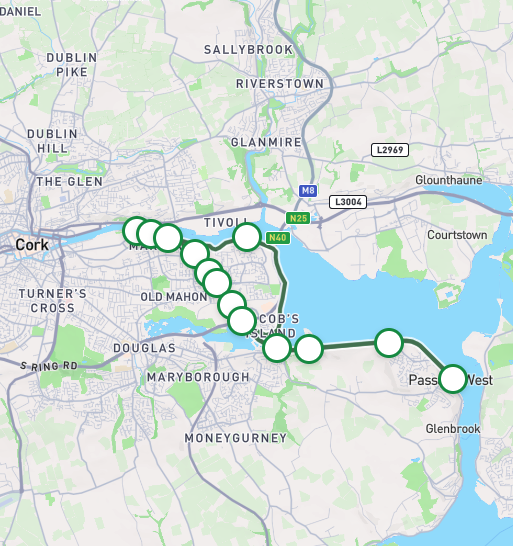
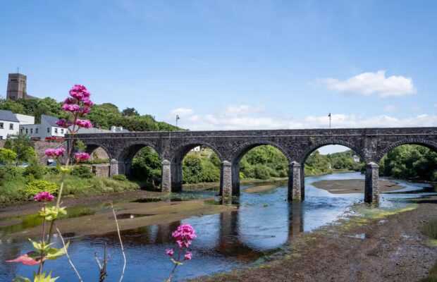
The Cork Marina to Passage West Greenway refers to a 20-kilometre scenic looped route built on the trackbed of the former Cork, Blackrock and Passage Railway Line, it offers users stunning views across Cork Harbour, one of the world’s largest natural harbours. Starting at the Marina near the River Lee, it winds through Cork City’s southeast suburbs to Passage West.  

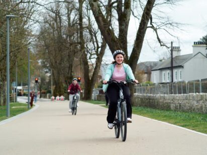
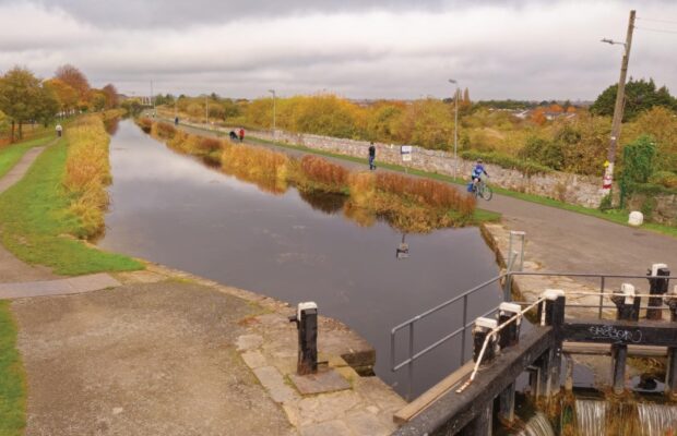
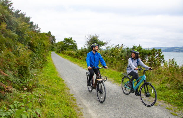
This is a calm, traffic-free route with wide paths, fresh air and great views across the water. The upgraded Marina Promenade and old harbour railway line make it an easy, scenic spin for users of all levels. On the way back, users can opt to return to the Marina using a route that runs parallel to the shoreline and passes Blackrock Observatory. The width of the path does narrow on some extended sections to 2 meters from the typical 3 meters found on a greenway route.  


Marina - Harty’s Quay

4.3km

The route starts at the Marina Promenade on the southern side of the city, offering scenic views along the River Lee. You will initially travel through the 32-hectare Marina Park set in the shadow of the SuperValu Páirc Uí Chaoimh stadium. In recent years, the park has been revitalised with a large playground, restored historic features such as Barrington’s Folly and Dundanion Castle slipway, and extensive works undertaken at the Atlantic Pond.  

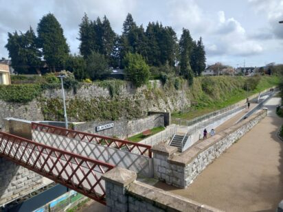
As you leave the park, you will enter the railway cutting associated with the Cork, Blackrock and Passage West Railway – this line closed in 1932. You pass through the old Blackrock Station, where the platform, signalling cabin and pedestrian bridge have been preserved—retaining the charm of a bygone era. Continuing along this tree lined route, you pass through short tunnels decorated with murals before reaching the footbridge spanning the N40. This is a steep and narrow (2-meter-wide) bridge, so please be respectful of other users.  

Before crossing the bridge, you may divert right to Mahon Shopping Centre or left towards Bessboro Road via two short off-road paths. After crossing the N40, you then cross the Black Bridge, a steel bridge providing access into the next section of the route towards Harty’s Quay. 

Harty’s Quay – Passage West

Harty’s Quay – Marina (via Blackrock)

Continuing your journey

Need to Know

Gradients are gentle though there is a notable ascent/ descent when cross the N40 via the bridge.

The width of the path does narrow on some extended sections to 2 meters on the approach into Passage West from the typical 3 meters found on a greenway route. There is a section after Harty’s Quay where the off-road route merges with a local road with a wide path running adjacent to the road for approximately 450 meters providing kerb separation for walkers and cyclists. In addition, there is no cycle lane from Blackrock Observatory to Blackrock village and the foot path is narrow.

The Cork Marina to Passage West Greenway supports rich biodiversity across coastal wetlands, woodlands and freshwater habitats. Recent enhancements in the Marina Park have transformed this route into a haven for wildlife and plant diversity with over 200 semi-mature trees now lining the path, creating shelter for birds and pollinators. There are more than five acres of planting, including shrubs, wildflowers, water-based plants, and bulbs add bursts of colour and seasonal interest while supporting insects and small mammals. The Atlantic Pond attracts swans, herons, and even otters with a new soft, planted edge added around the Pond. 

Tidal mudflats near Blackrock provide feeding grounds at low tide for wading birds like oystercatchers and godwits. Along this stretch, clusters of trees and wildflowers such as honeysuckle, dogtooth violet and oxeye daisies are present. Although the route passes through urban areas, it forms a living ecosystem with varied habitats. 

Code of conduct

Code of Conduct

To keep our greenways welcoming and safe for all users—walkers, cyclists, families, and wildlife alike—please review our Code of Conduct before you go.

Read Code of Conduct

Getting There

Whether you’re travelling by train, bus, or car, use these tools 
to plan your route.

Common Questions

How can I access the Greenway?

There are numerous access points to the Greenway along the route:

  • Access from/to junction of Centre Park Road and Marina Promenade
  • Access from/to Pairc Ui Chaoimh
  • Access from/to Holland Park
  • Access from/to Blackrock Station [Ramp/Steps]
  • Access from/to Access from/to Convent Garden [Ramp]
  • Access from/to North of Skehard Road [Ramp]
  • Access from/to North of Skehard Road [Step]
  • Access from/to South of Skehard Road [Step]
  • Access from/to North of Mahon Link Road [Ramp]
  • Access from/to South of Mahon Link Road [Ramp]
  • Access from/to Bessboro
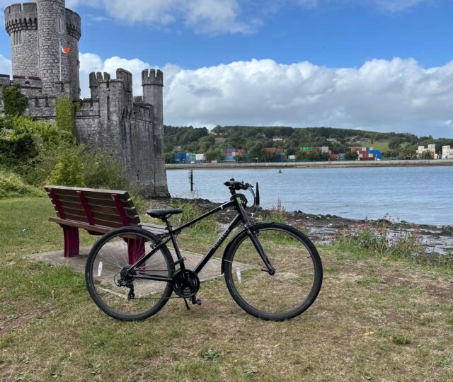
  • Access from/to Blackrock Castle
  • Access from/to Harty’s Quay car park
  • Access from/to Hop Island car park
  • Access from/to Passage West Greenway car park


How can I access the Greenway on public transport?

There are daily train via Kent Station and bus services to Cork City, which is within walking distance to Marina Promenade. There is also a local bus service available

For further information please visit:  https://www.transportforireland.ie/

What car parking and EV charging facilities are along the Greenway?

Ample parking is available at key entrances to the greenway, including Marina Promenade, Hartys Quay and Hop Island. Designated accessible parking spaces are also available at these points.

Currently, there are no electric vehicle charging points available at the greenway entrances or along the route.

What is the surface type on the Greenway?

The entire greenway is smooth with no gravel used along the route.

Are there any water facilities along the Greenway?

There is a water fountain located at entry/exit plaza at Ballisheedy Bridge, north of Skehard Road.

Are there any bike parking, repair and hire facilities along the Greenway?

There are bike parking facilities at the following locations: start of the Marina Promenade, plazas on the Marina Promenade, viewing point at Black Bridge, Harty’s Quay car park and Outdoor gym located adjacent to Harty’s Quay. 

There is no bike repair facilities along the route.

There is a bike hire operator operating in Cork Marina Market, further details can be found online 

Are there any seating facilities along the Greenway?

Rest facilities are located along the route at the following locations: Marina PromenadeHolland Park, Blackrock StationEntry/exit from Skehard Road at Ballinsheen Bridge, Mahon Link RoadBlack Bridge as well as along the shared path from Hop Island to Passage West. 

Are there any toilet facilities along the Greenway?

There are no toilets or changing facilities located along the route. There are public toilets located in Passage West (on the main street).

Are there any playgrounds along the Greenway?

There is a play area located in Holland Park. There is an outdoor gym along the route adjacent to Hartys Quay.

News and Updates

View All
Grand Canal Greenway Update
Route Updates
11 Jun 2026

Grand Canal Greenway Update

Closure Area In 2026 approximately 2km directly south of Edenderry, generally from Blundell Aqueduct to Downshire Bridge, will be closed to the public. Following completion...
Read More about Grand Canal Greenway Update
Royal Canal Greenway Update
Route Updates
04 May 2026

Royal Canal Greenway Update

Dublin City Council, through its Active Travel Programme Office, advises that a section of the Royal Canal towpath will be temporarily closed to the public...
Read More about Royal Canal Greenway Update
Carlingford Lough Greenway Update
Route Updates
04 May 2026

Carlingford Lough Greenway Update

Users of the Carlingford Lough Greenway are advised of a temporary closure to facilitate works at Narrow Water Bridge starting on Tuesday 26 May for...
Read More about Carlingford Lough Greenway Update