South East Greenway

New Ross Waterford
Distance
14 km
Elevation
110m
Time
Cycling: 1 hr
Walking: 3 hrs 40 mins
Surface Finish
Smooth Surface
South East Greenway
Gallery image 1
Gallery image 2

Overview

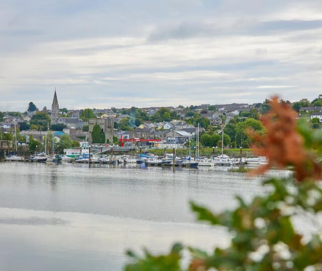
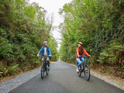
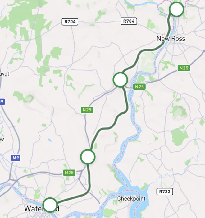
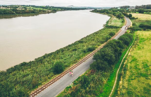
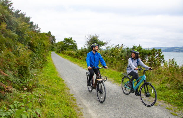
The South East Greenway will connect the Viking City of Waterford to the Norman town of New Ross in Co. Wexford when completed. Running alongside the river Barrow, this greenway will pass through south Kilkenny and on top of the track bed of an disused railway line.Visitors can now begin their journey in New Ross and travel 8 kilometres to Glenmore. A separate section from Curraghmore to Waterford City is also open, offering another 6 kilometre route between those locations. With gentle gradients and a smooth surface, this route is suitable for all levels of fitness and ability.  

Once complete, this route will be 24.5 kilometres long and incorporate built heritage features such as the 177 meter long wrought iron Red Bridge over the River Barrow as well as the approximately 700 meter long Mount Elliot curved tunnel with 4 brick sections just after the Red Bridge. It will provide a safe and attractive route between New Ross and Waterford City and offer a link to Waterford Greenway. It is envisaged that the greenway will be fully opened by 2028.  

New Ross - Glenmore 

8km

The greenway starts at the old rail yard in Rosbercon on the western side of New Ross. There are bike and car parking spaces as well as a picnic area, seating, toilets as well as a bike shop nearby. Heading south, you will leave the town of New Ross as the route quickly becomes secluded – at times the route travels adjacent to the river offering lovely waterside views. The route ends at Glenmore just north of the Rose Fitzgerald Kennedy bridge. There is a trailhead at this location with plentiful bike and car parking spaces.    

Curraghmore - Waterford City

Need to Know

Gradients are gentle. The urban section of the greenway is 4m wide and the rural sections are 3m wide. Access ramps comply with the Rural Cycling Guidelines.  

From time to time, charity runs and cycles will also be organised on the Greenway – Wexford County Council, Kilkenny County Council and Waterford City and Council have a formal process in relation to applications to run events on the Greenway. More information on this process as well as seasonal events can be found on www.wexford.ie, www.kilkenny.ie or www.waterfordcouncil.ie.  

Route connects with…
Waterford Greenway

Waterford City Dungarvan
Distance: 48km
Cycling: 3hrs
Walking: 11 hrs
The Waterford Greenway is one of Ireland’s most spectacular off-road walking and cycling trails, stretching 48 kilometres from the historic Viking city of Waterford to the lively coastal town of Dungarvan. This route travels through time and nature across eleven bridges, three impressive viaducts and a long atmospheric tunnel all the way from the River...
Biodiversity

There is a strong theme of railway heritage along the South East Greenway with the railway originally constructed in the late 1800s with disused railway stations at Glenmore and Rosbercon located along the route. The line was used to transport animal feed, sugar, flour, chests of tea and barrels of Guinness to New Ross and was used to transport local produce such as salmon, poultry and beef out of New Ross through contracts with English markets and traders. While passenger traffic along the line had ceased by the 1970s, the railway line continued to have an important economic function in transporting freight primarily agricultural fertiliser and sugar beet until the 1990s.  

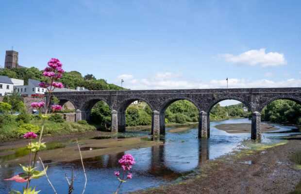
The remnants of the railway can still be seen on the landscape today with built heritage assets such as the extensive Mount Elliot Tunnel, the Barrow Red Bridge and a variety of bridges along the route. The Barrow Red Bridge was constructed in the 1800s having been designed by John Chaloner Smith. The approximately 700-meter-long Mount Elliot tunnel runs directly from the bridge on the east side of the River Barrow. The restoration of the tunnel as part of the South East Greenway marks an exciting new purpose for this historical structure  

Code of conduct

Code of Conduct

To keep our greenways welcoming and safe for all users—walkers, cyclists, families, and wildlife alike—please review our Code of Conduct before you go.

Read Code of Conduct

Getting There

Whether you’re travelling by train, bus, or car, use these tools 
to plan your route.

Common Questions

How can I access the Greenway?

The Greenway can be accessed at Rosbercon  Trailhead in New Ross and at Glenmore Trailhead. There are other local access points along the route but access via the formal access points is encouraged.  

How can I access the Greenway on public transport?

There are daily bus services between New Ross and Waterford, New Ross and Wexford, New Ross and Enniscorthy, New Ross and Kilkenny. There are daily train services between Waterford and Dublin, Limerick and Cork. More information on these services can be viewed on www.transportforIreland.ie and on Irishrail.ie.  

What car parking and EV charging facilities are along the Greenway?

There is car parking available at Rosbercon (New Ross) and Glenmore trailheads.  There is currently no EV charging along the route.

What is the surface type on the Greenway?

The entire route is smooth with no gravel surface along the route.  

Are there any water facilities along the Greenway?

No water fountain facilities are available on the route.  

Are there any bike parking, repair and hire facilities along the Greenway?

There are bike parking facilities located along the route.  

No bike repair stations are available along the route.  

Greenway Waterford Bike Hire on Grattan Quay in Waterford City also provides bike hire. Further information on these services can be found online. Any reference to specific bike hire operators should not be regarded as a recommendation for their services.

Are there any seating facilities along the Greenway?

There are several benches located along the route.  

Are there any toilet facilities along the Greenway?

There are no public toilets located along the route. There are public toilets in New Ross Town Park (1.3km from the Rosbercon trailhead).  

Are there any playgrounds along the Greenway?

There are no playgrounds located along this route.  

News and Updates

View All
Grand Canal Greenway Update
Route Updates
11 Jun 2026

Grand Canal Greenway Update

Closure Area In 2026 approximately 2km directly south of Edenderry, generally from Blundell Aqueduct to Downshire Bridge, will be closed to the public. Following completion...
Read More about Grand Canal Greenway Update
Royal Canal Greenway Update
Route Updates
04 May 2026

Royal Canal Greenway Update

Dublin City Council, through its Active Travel Programme Office, advises that a section of the Royal Canal towpath will be temporarily closed to the public...
Read More about Royal Canal Greenway Update
Carlingford Lough Greenway Update
Route Updates
04 May 2026

Carlingford Lough Greenway Update

Users of the Carlingford Lough Greenway are advised of a temporary closure to facilitate works at Narrow Water Bridge starting on Tuesday 26 May for...
Read More about Carlingford Lough Greenway Update