Tralee – Fenit Greenway

N Kerry - Tralee Fenit
Distance
14 km
Elevation
100m
Time
Cycling: 1 hr
Walking: 3 hrs
Surface Finish
Smooth Surface
Tralee – Fenit Greenway
Gallery image 1
Gallery image 2

Overview

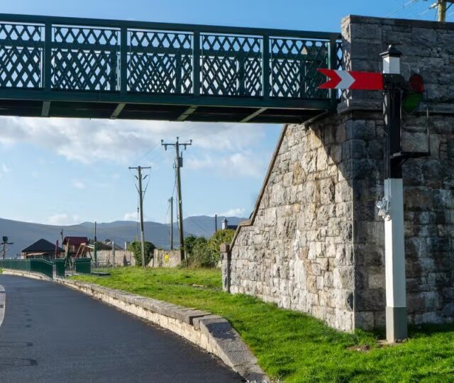
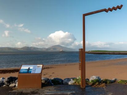
The Tralee–Fenit Greenway is a coastal route in County Kerry, running from the town of Tralee to the seaside village of Fenit offering breathtaking views of Mount Brandon, Tralee Bay and Fenit Harbour, which is one of the discovery points along the Wild Atlantic Way. This 13.6km route is built along the former Tralee to Fenit railway line and offers a mixture of rural calm and stunning seascapes. 

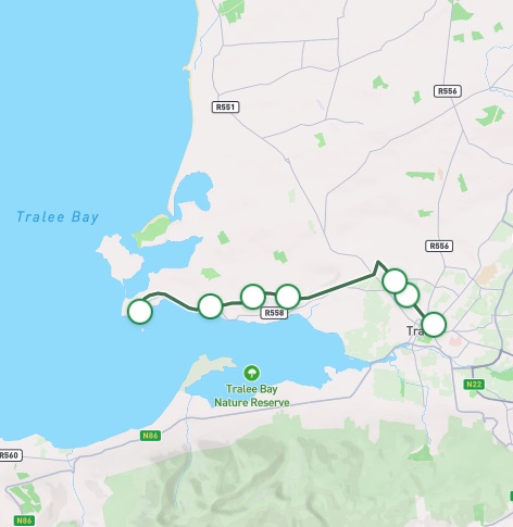
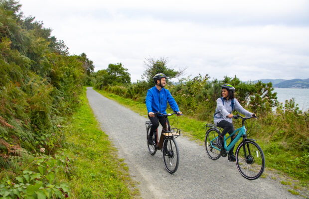
The greenway begins beside Tralee train station passing The Spa, Cotters Bend and Kilfenora before winding along the Tralee Estuary, offering unforgettable views of Tralee Bay before finishing at Fenit – a bustling fishing harbour village. The route is fully off-road with a smooth surface, making it ideal for family outings, leisure cycling and walking. The story of the transition from an abandoned railway corridor to a greenway was born from a collaboration between local government, environmental groups and community advocates.  

Tralee – Cotter’s Bend

8.6 km

The route starts beside the Casement railway station in Tralee, a large sign spans the entrance to the greenway which is located adjacent to the R878.  Tralee, the capital of County Kerry, offers a lot for visitors to see and do. Combining culture, history, and family-friendly attractions, making it a great base for exploring the region. Highlights include the Kerry County Museum, where you can dive into local history and heritage; the Aqua Dome, a popular indoor water park for families and rainy days; and the Tralee Bay Wetlands Eco & Activity Park, an ideal spot for nature walks, birdwatching, and outdoor adventures. 

As you leave the town, please take care at the road crossings and junctions along the initial section of the route. Free designated car parking is available at Mounthawk Park which is located approximately 1.5km from the starting point. Beyond the town,  the greenway opens into farmland and hedgerows, with distant views of the Slieve Mish mountain range providing a scenic   backdrop. Please be respectful of local farmers who may be moving livestock across the route. Further along, Cotter’s Bend acts as a natural midpoint with a rest area providing the opportunity for a break before continuing your journey. 

Cotter’s Bend – Fenit

Need to Know

Gradients are gentle along the route.

Hot showers, changing areas, toilets, secure storage, equipment washdown areas, and a changing places facility are all available at the facilities centre in Fenit. There is a charge to use these facilities.

Ciars Quest is an augmented reality experience available to users of the Tralee to Feit Greenway. See https://ciarsquest.ie for more details of this free fun family adventure focusing on Biodiversity along the greenway.

Fenit Greenway parkrun takes place every Saturday at 9:30am commencing at the Fenit Greenway Trail head.


The stunning Tralee Bay provides a range of marine habitats including mudflats, estuaries, rocky seashores, sand dunes and more, in turn supporting a variety of species some of which are endangered including the undulate ray. The bay is also frequented by bottlenose dolphins, angel sharks and is one of the only self-seeding wild Irish oyster fisheries found in Europe.

The vibrant hedgerows along the greenway are an essential haven for the more than fifty species of Irish birds, thirty-five of which nest in the hedgerows, and several species remain in the area year-round such as robins, blackbirds, wrens and the distinctive pied wagtail. Hedgerows provide food, shelter, perches and song posts, as well as protective corridors for the birds’ movement.

The bedrock of the Tralee to Fenit Greenway is largely made up of varying forms of limestone, sandstone and shale, with formations on display at several points along the route. The limestone walls close to Fenit are covered in ivy, while other exposed limestone faces display dozens of brilliant plant species. The exposed shale cliff face near Oyster Hall reveals repeating layers of bedrock, reflecting changing sea levels over time, and features like shale kinks and limestone bedding planes offer important glimpses into how the land has moved and evolved over time.

Visitors can experience this rich biodiversity from the path itself, with interpretation boards explaining key species. Respecting signage and keeping to the trail are essential, especially in sensitive coastal zones where disturbance could impact feeding and roosting birds.

Code of conduct

Code of Conduct

To keep our greenways welcoming and safe for all users—walkers, cyclists, families, and wildlife alike—please review our Code of Conduct before you go.

Read Code of Conduct

Getting There

Whether you’re travelling by train, bus, or car, use these tools 
to plan your route.

Common Questions

How can I access the Greenway?

Visitors can join or leave the route in Tralee close to the Casement Railway Station, at Bracker O’Regan Road, the Mounthawk Park, Cotter’s Bend, Kilfenora and Fenit Trailhead. 

How can I access the Greenway on public transport?

There are buses to Tralee provided by Bus Éireann, Dublin Coach and Local Link service, and train service to Tralee from Dublin, Cork, Limerick and other stations around Ireland. Visitors can also fly into Kerry Airport and get a connecting bus or train to Tralee.

The Train and Bus Station in Tralee is located at the trailhead. Local Link Kerry service #278 runs between Fenit and Tralee 7 times each day.

For more information please visit: https://www.transportforireland.ie/

What car parking and EV charging facilities are along the Greenway?

Free parking including accessible parking is available at the Fenit trailhead. Additional paid parking can be found in Tralee town, including EV Charging facilities.

What is the surface type on the Greenway?

The entire route is smooth with no gravel surface along the route.

Are there any water facilities along the Greenway?

A water fountain is available in Fenit at the facility centre.

Are there any bike parking, repair and hire facilities along the Greenway?

Bike parking facilities are located along the route at Cotter’s Bend (52°16’43.6″N 9°48’38.2″W), shortly after Glenside (52°16’52.9″N 9°48’01.9″W) and at Lassinagh (52°16’50.5″N 9°46’49.5″W) as well as the facilities centre in Fenit.

A bike repair station can be found at the Cotters Bend area of the route (52°16’52.9″N 9°48’01.9″W).

Tralee Bike Hire is located close to the start the Tralee to Fenit Greenway beside Tralee Train Station. https://traleebikerental.ie/

Like Bikes offer a drop and collect service along the Tralee to Fenit Greenway. https://www.likebikes.ie/rental/tralee-bike-rental/

Any reference to specific bike hire operators should not be regarded as a recommendation for their services.

Are there any seating facilities along the Greenway?

Rest facilities are located on the route at Cotter’s Bend (52°16’43.6″N 9°48’38.2″W), shortly after Glenside (52°16’52.9″N 9°48’01.9″W) and at Lassinagh (52°16’50.5″N 9°46’49.5″W) as well as the facilities centre in Fenit.

Are there any toilet facilities along the Greenway?

Public toilets are available at the facility centre in Fenit.

There are no toilet facilities available on the greenway route.

Are there any playgrounds along the Greenway?

There is a playground at the Fenit Trailhead.

News and Updates

View All
Grand Canal Greenway Update
Route Updates
11 Jun 2026

Grand Canal Greenway Update

Closure Area In 2026 approximately 2km directly south of Edenderry, generally from Blundell Aqueduct to Downshire Bridge, will be closed to the public. Following completion...
Read More about Grand Canal Greenway Update
Royal Canal Greenway Update
Route Updates
04 May 2026

Royal Canal Greenway Update

Dublin City Council, through its Active Travel Programme Office, advises that a section of the Royal Canal towpath will be temporarily closed to the public...
Read More about Royal Canal Greenway Update
Carlingford Lough Greenway Update
Route Updates
04 May 2026

Carlingford Lough Greenway Update

Users of the Carlingford Lough Greenway are advised of a temporary closure to facilitate works at Narrow Water Bridge starting on Tuesday 26 May for...
Read More about Carlingford Lough Greenway Update